 Deutsch
 English
 Französisch
 Niederländisch
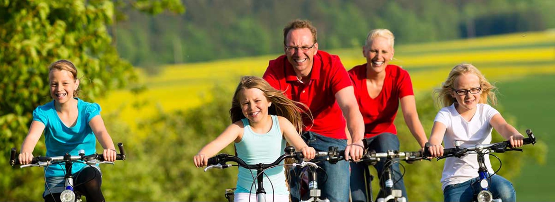
We are an award-winning Bed & Bike Hotel
Welcome to the most beautiful routes in the Saar-Radland. The Saarland has 40 signposted cycle paths. From easy stretches through valleys and river landscapes to demanding high-altitude tours. Destinations in France, Luxembourg or Lorraine can also be reached via different routes.
The Hotel Mühlenthal is an award-winning bed & amp; Bike hotel. Thanks to its central location between Saarlouis and Saarbrücken, the three-star hotel is the ideal starting point for extensive bike tours: Explore the country and people of southwest Germany on your own bike. The signposted Saarland cycle path starts right at the Hotel Mühlenthal.
Free bike service
We are bike friendly. Of course, our hotel guests receive the following free bike service:
- Sufficient parking space
- Garages
- Tools
- Drying room
- Shuttle service for luggage
- Information material / cycling maps
Bookable additional service
Would you like a little more? Our hotel guests can book the following additional services with us:
- Lunch package: €5.00 / lunch package
- Rental of an e-bike: weekly flat rate: €85.00/ E-bike
- E-bike rental: Weekend flat rate: €35.00 / E-bike

-

Saar-Nahe-Höhen cycle path: 81.6 km
From Güdingen an der Saar, the cycle path initially runs in an easterly direction through floodplains past small excursion restaurants. After a few kilometers, an ascent leads to the high-altitude Ensheim Airport. Following an old Roman path, you then continue on the heights of the Bliesgau in the direction of Heckendalheim. The open Gau landscape with its orchards and wide views is worth the climb. After a descent into the beautiful Alschbach valley, the route continues to the baroque town of Blieskastel. Through the Kirkeler Forest with its bizarre rock formations, past the Kirkeler Burg , the cycle path continues in a northerly direction to Bexbach. In the Saarland Mining Museum, visitors can go underground to see old and new mining methods at authentic locations. A short, urban section leads through Neunkirchen, where the industrial culture and history of the city can be experienced on themed trails. Over 500 animal species await visitors in Neunkirchen Zoo. The cycle path now leaves the urban area on a former Roman road and leads through a very scenic area with many distant views. The Oberthaler Bruch nature reserve with its great biodiversity leads to the Bostalsee . Idyllically embedded in the wooded low mountain range, the largest lake in southwest Germany is a popular excursion destination with numerous leisure activities. The local cycle path, which connects the source of the river at Selbach with the estuary at Bingen am Rhein, passes by Lake Bostalsee. The Saar-Nahe-Höhen-Radweg can be easily combined with the north passage of the Saarland-Radweg and the Saar-Radweg to a multi-day round tour.
With the following link from the Saarland Tourist Office you can get all information and geo-data:
Burbach-Köllertal circuit: 51.3 km
Three attractive valleys, the Saar, the Köller and the Burbach valleys and the mountain ranges in between with panoramic views characterize the all-day bike tour. As a special highlight, the World Heritage Site Völklinger Hütte is right on the route.
Tour route: Burbacher Waldweiher - Burbachertal - outskirts of Riegelsberg - Ritterstraße - Engelfangen - Köllertal - Walpershofen - Schwalbach-Elm - Wackenmühle - Köllertal - Völklingen - World Heritage Site Völklinger Hütte - Saar Cycle Path - Europe Bridge - Burbach - Burbach forest pond
This tour is not signposted with its own logo.
Start in the direction of Riegelsberg. Below Von-der-Heyt, follow the orange-red signs for the Velovisavis main route into the Köllertal. From Köllerbach, follow the Köllertal cycle path with the green Saarland logo. In Walpershofen change to the Velo visavis route towards Schwalbach-Elm . In front of the Wackenmühle, follow the Velo visavis main route again. From the Wackenmühle follow the Köllertal cycle path to Völklingen. After crossing the Saar, follow the Saar cycle path with the blue Saarland logo. At the level of the former Burbacher Hut, turn right under the Autobahn. Follow the signs to Burbach.
With the following link from the Saarland Tourist Office you can get all information and geo-data:

-


-

European Mill Cycle Path: 47.6 km
The cross-border route of the European Mill Cycle Path leads through the landscape of the Saar-Palatinate and Lorraine border region and is all about water. The cycle path leads through river valleys and forests as well as over ridges with wonderful views. From Zweibrücken the path first leads over a former railway embankment to the monastery town of Hornbach with the grave of St. Pirminius. In the valley of the swallow it goes briefly over to France. The way back of the circuit runs through the "Parr" (parish), a heavenly, peaceful rural landscape around the valley of the Bickenalb. Over 10 mills are located along the way and testify to the miller's trade, which was once important in this region. The highlight is without a doubt the mill and sawmill museum at the Eschviller mill in Volmunster. Here you can still see how grain and wood are processed with hydropower
With the following link from the Saarland Tourist Office you can get all information and geo-data:
VeloRoute SaarLorLux: 482.3 km
The VeloRoute runs mainly along the easy-to-cycle river valleys of the Saar, Moselle and Sauer to the cultural highlights and the scenic beauties of the triangle with its unmistakable flair. Wonderful river landscapes, the vineyards of Saar and Moselle, Lorraine lakes and the lovely Sûre valley are just as much on the route as the beautiful cities of Saarbrücken, Metz, Luxembourg and Trier. Most of the route runs on back roads and developed bike paths
The starting point and also the end point of the Velo Route SaarLorLux is the metropolis on the Saar - Saarbrücken. The first part of this stage runs through pretty little towns like Saargemuines and Saaralb, directly along the Saar. This is followed by the Lorraine forest up to the Moselle and Metz (186.5 km). From Metz in Lorraine, which has a lot of attractions and fine dining to offer, the 104.5 km long stage, along the Moselle, through the town of Thionville to Remich. From here you continue through the vineyards to the capital of the Grand Duchy of Luxembourg. The third section with a length of 80.5 km runs through the Grand Duchy of Luxembourg in a rural area to Echternach, which is located in the idyllic valley of the Sauer. Following the course of the Sauer, it then goes to the historic Trier. The last, 102 km long stage leads from the Roman city of Trier up the Moselle to the confluence of the Saar in Konz. From here it goes along the Saar past the lovely town of Saarburg and through the Merziger Land. On the way to the end of the tour in Saarbrücken, the route also passes Saarlouis and the UNESCO World Heritage Site Völklinger Hütte.
The following link from the Saarland Tourist Office provides you with all the information and geo-data:

-
